Geothermal Resource Develeopment
Conventional Geothermal
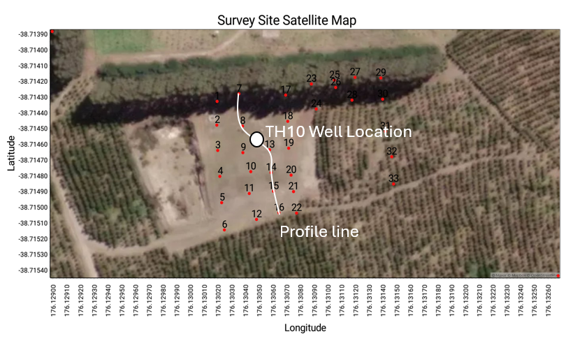
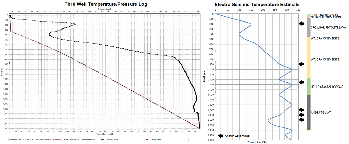
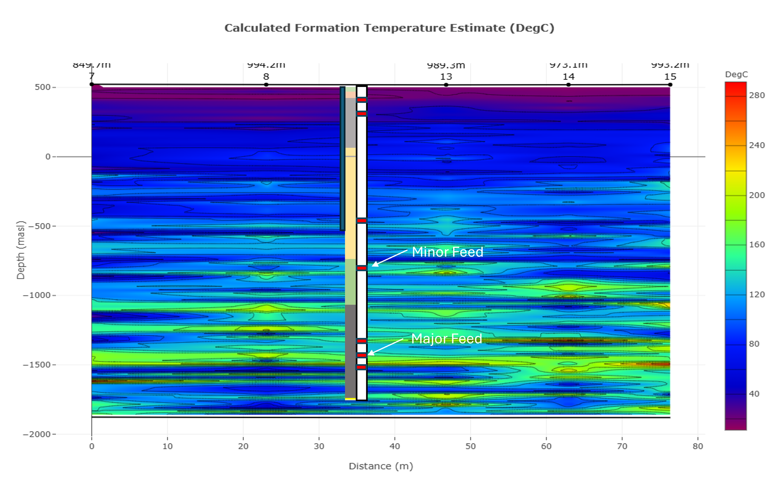
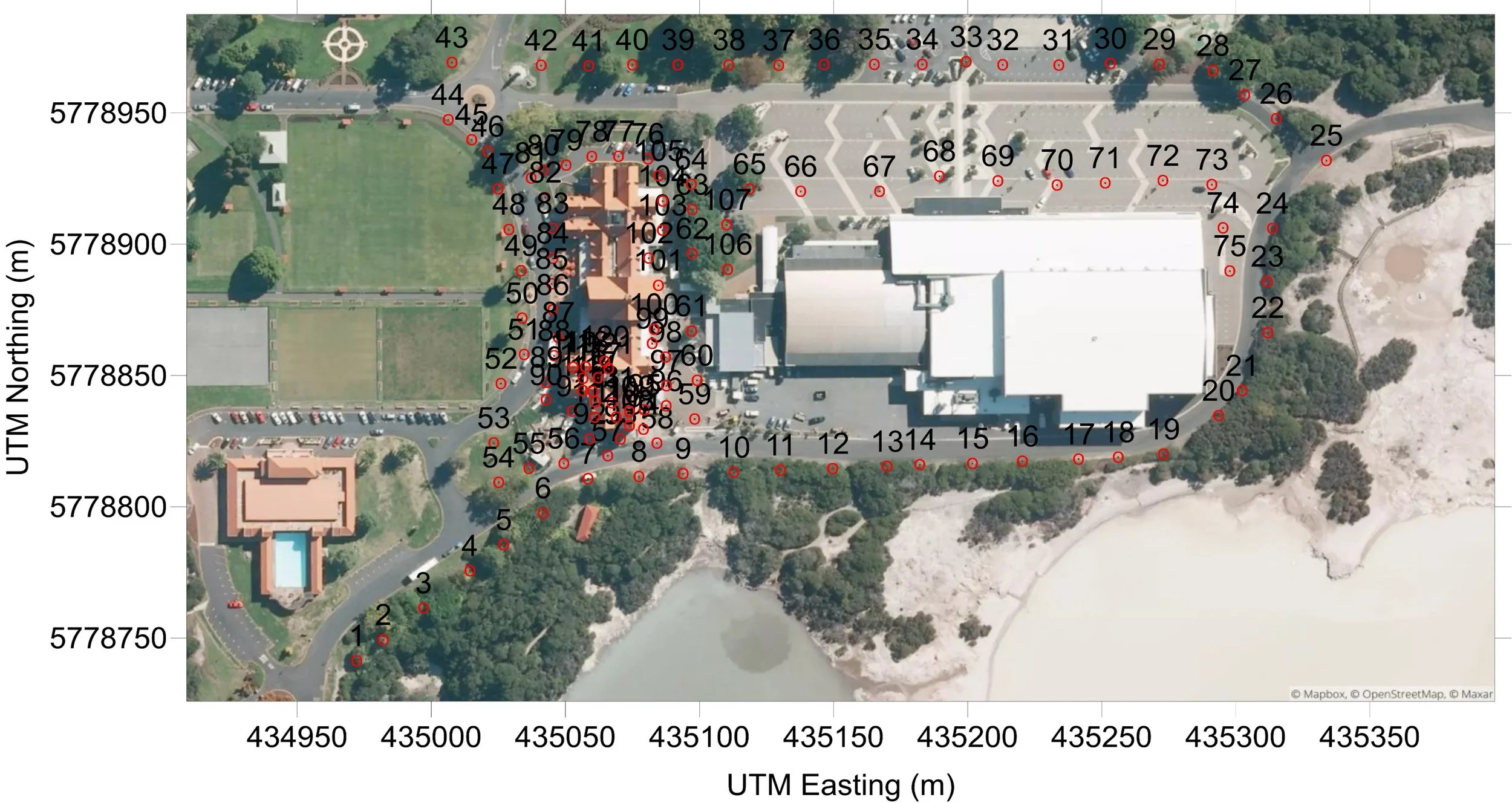
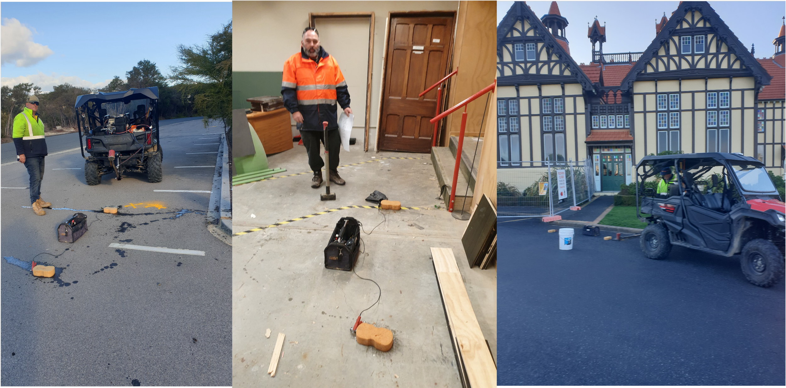
Geothermal Mapping, was tasked by Contact energy, new Zealand, to investigate the effectiveness of the Seismo electrics at delineating and quantifying the geo thermal resources under the TH10 geothermal well site, located in the Tauhara geothermal system. The objectives of the green field study, were to delineate the aquifers and define their hydrological properties, define geothermally active formations, with estimates of the formation and fluid temperature, then indicate any geothermal feed zones and provide yield estimates, and lastly to delineate any deeper geothermal potential below 2500 meters depth. The client provided an investigation depth limit of 3000 meters and indicated that the site was indeed geothermally active. No other information was provided by the client beforehand. To accomplish this a profile of points were surveyed across the TH10 well pad. The results of the survey were presented to Contact Energy and a comparison of the hydrological, thermal and feed depth well data was conducted by Contact Energy staff. The results of the comparative study were presented at the Geothermal Resources Council conference, in 2013.
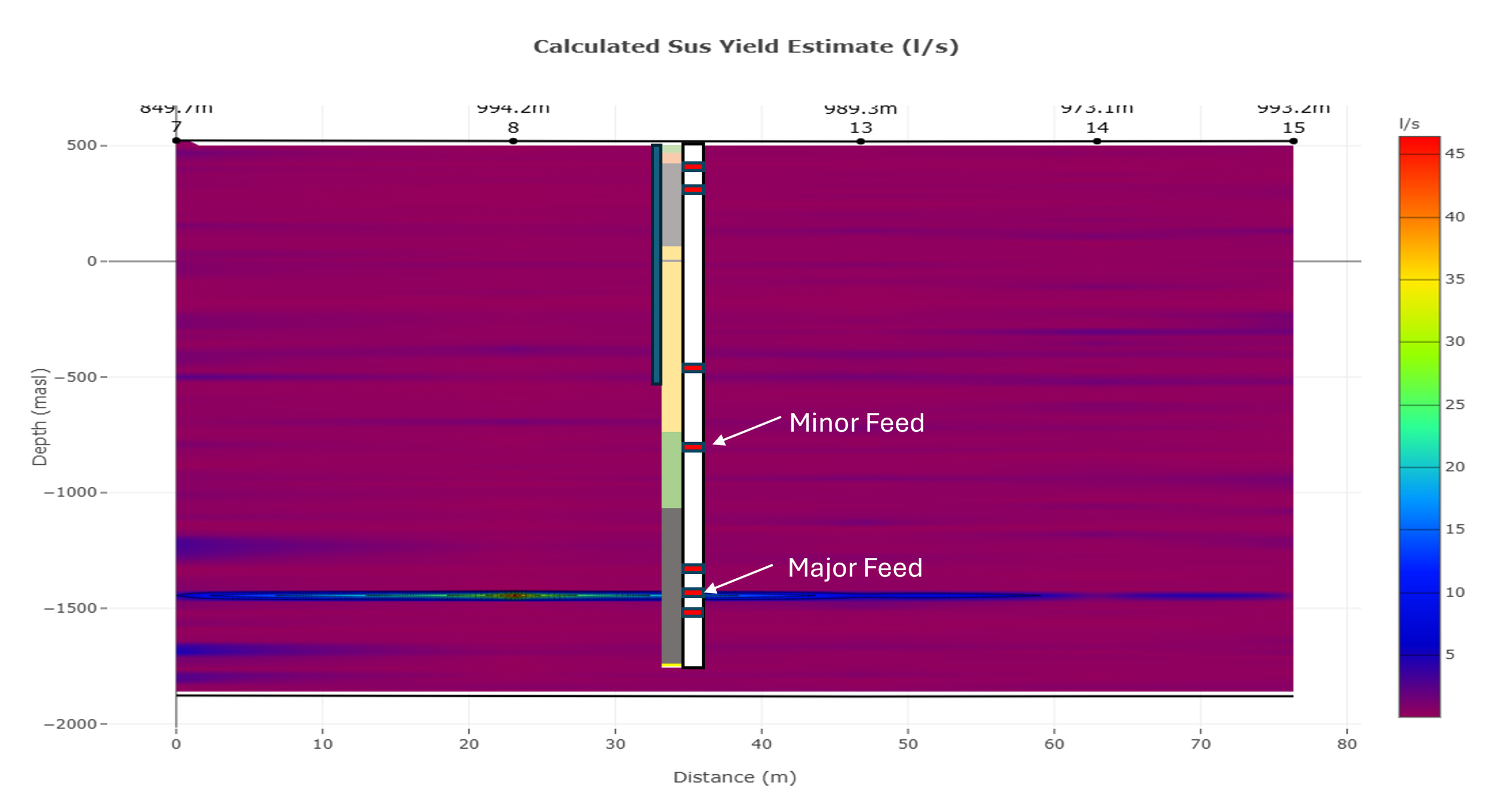
A comparison between the averaged ES formation temperature data for the site and the well log thermal data shows a high degree of correlation . The ES data shows indication of formation temperature overestimation around the known feed zones, which may be due to a more complex Seismo-electric conversion within the geothermal aquifer systems.
Geotechnical Geothermal
This project, done over the museum in Rotorua, New Zealand, was conducted to determine the source of shallow geothermal systems heating the building structures. A full survey of the site was conducted, and it was determined that the shallow geothermal system under the site was souring from a deeper system, through a transmissive gravel bed. The extent of the leaking heated water was mapped, and a remediation strategy was developed.
The fracturing data for the site, shown in grey, indicates a transmissive formation between the deeper geothermal resource and shallow geothermal leak zone. This formation effectively allowed the geothermal heat to transfer through the clay cap over the deep geothermal formations.
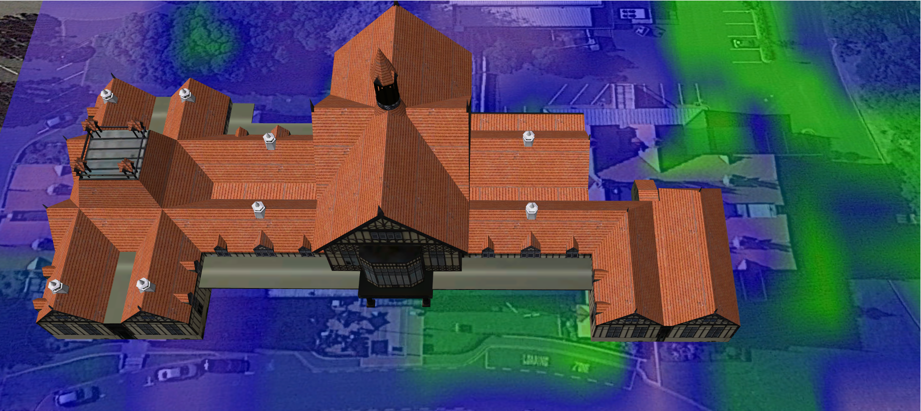
The temperature estimate data was calculated at a depth of 10m below surface level. It clearly shows that the geothermal leak exists under the southern side of the building, and spreading to south east.
Shallow Geothermal
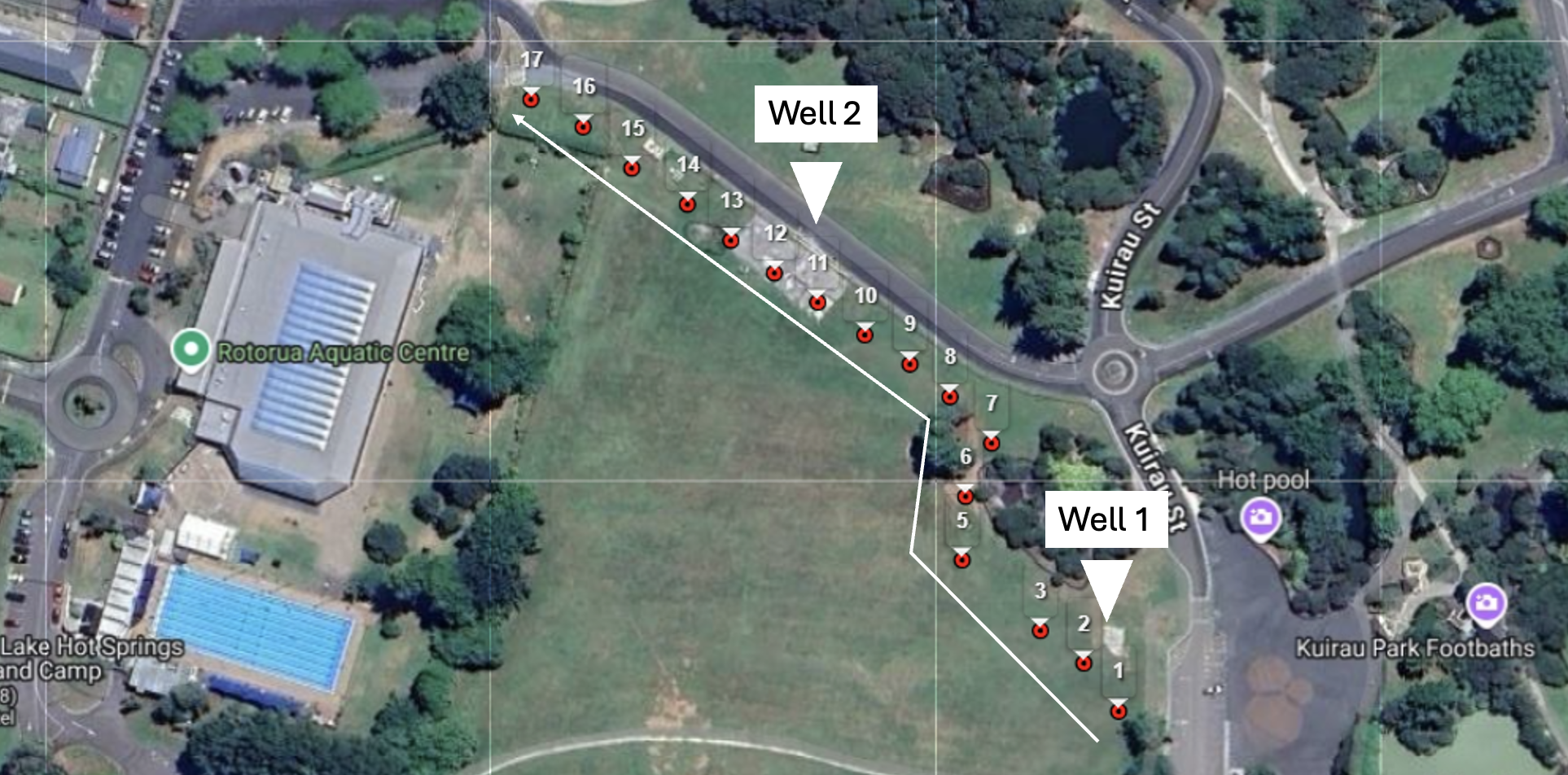
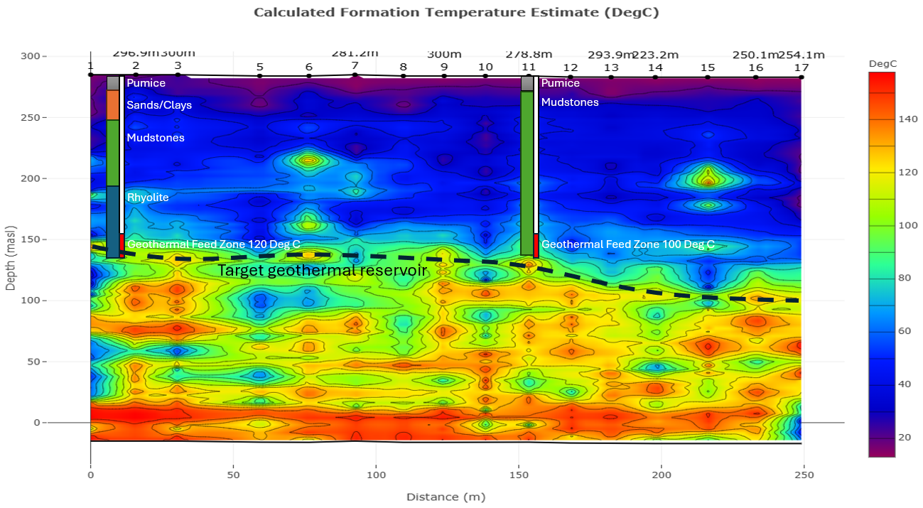
This project, done over the park in Rotorua, New Zealand, was conducted to locate a suitable geothermal well to replace the aging well suppling the heated pools with water. To accomplish this, 17 soundings were conducted and the major aquifers under the site were identified. Next the formations temperature was assessed and a drilling location was chosen to intersect the aquifer where the temperature was highest.
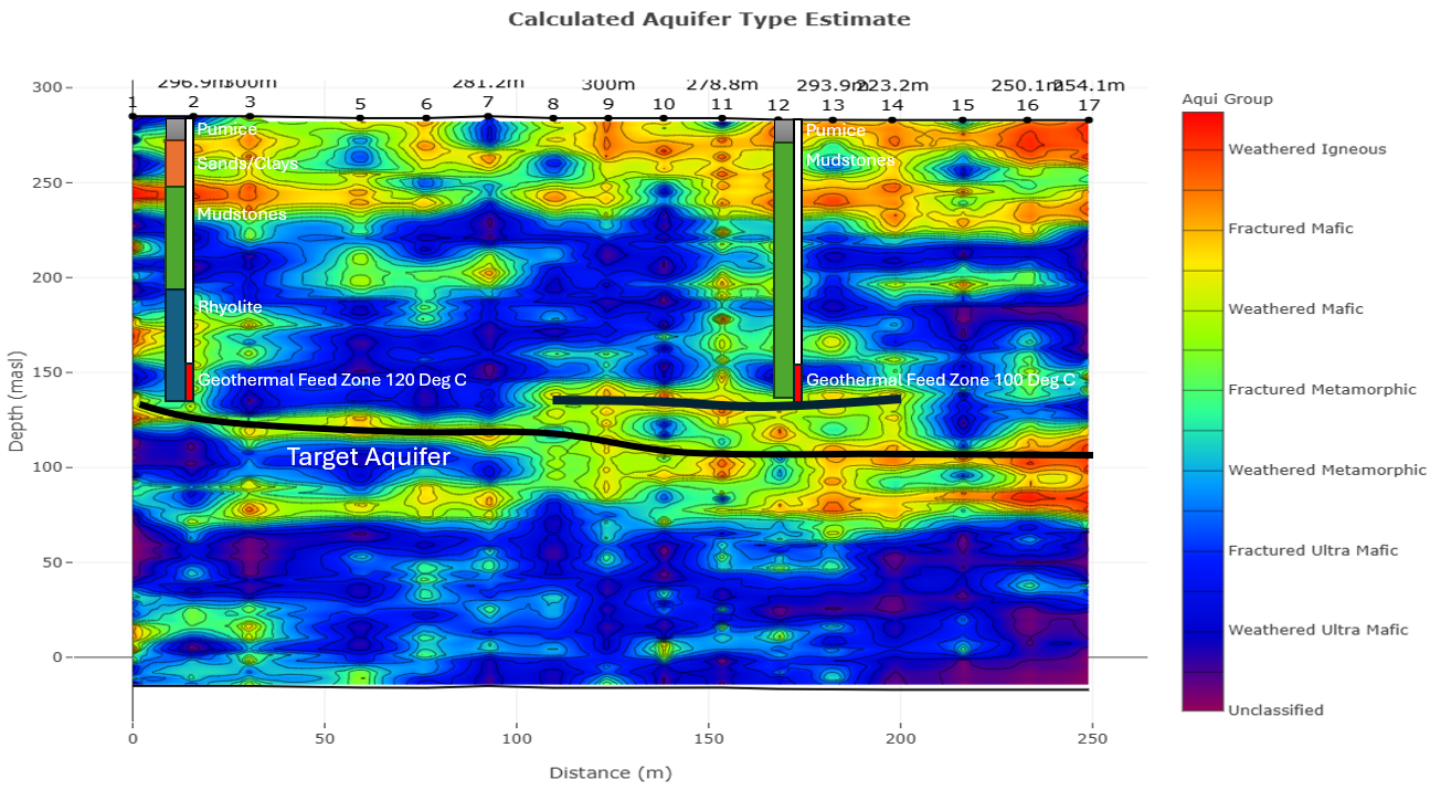
The aquifer type data shows fractured formations at a depth of 150 to 200mbsl, this was interpreted as the main aquifer system under the site
The temperature estimate data shows the geothermal reservoir starting at a depth of 150mbsl. The well was chosen to intersect this reservoir within the delineated aquifer.
Steam Injection
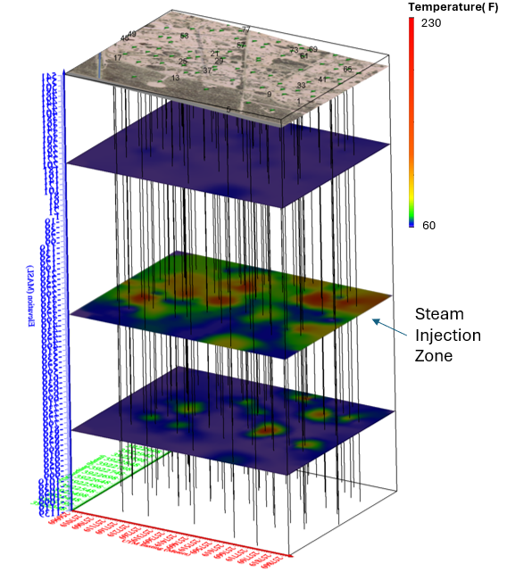
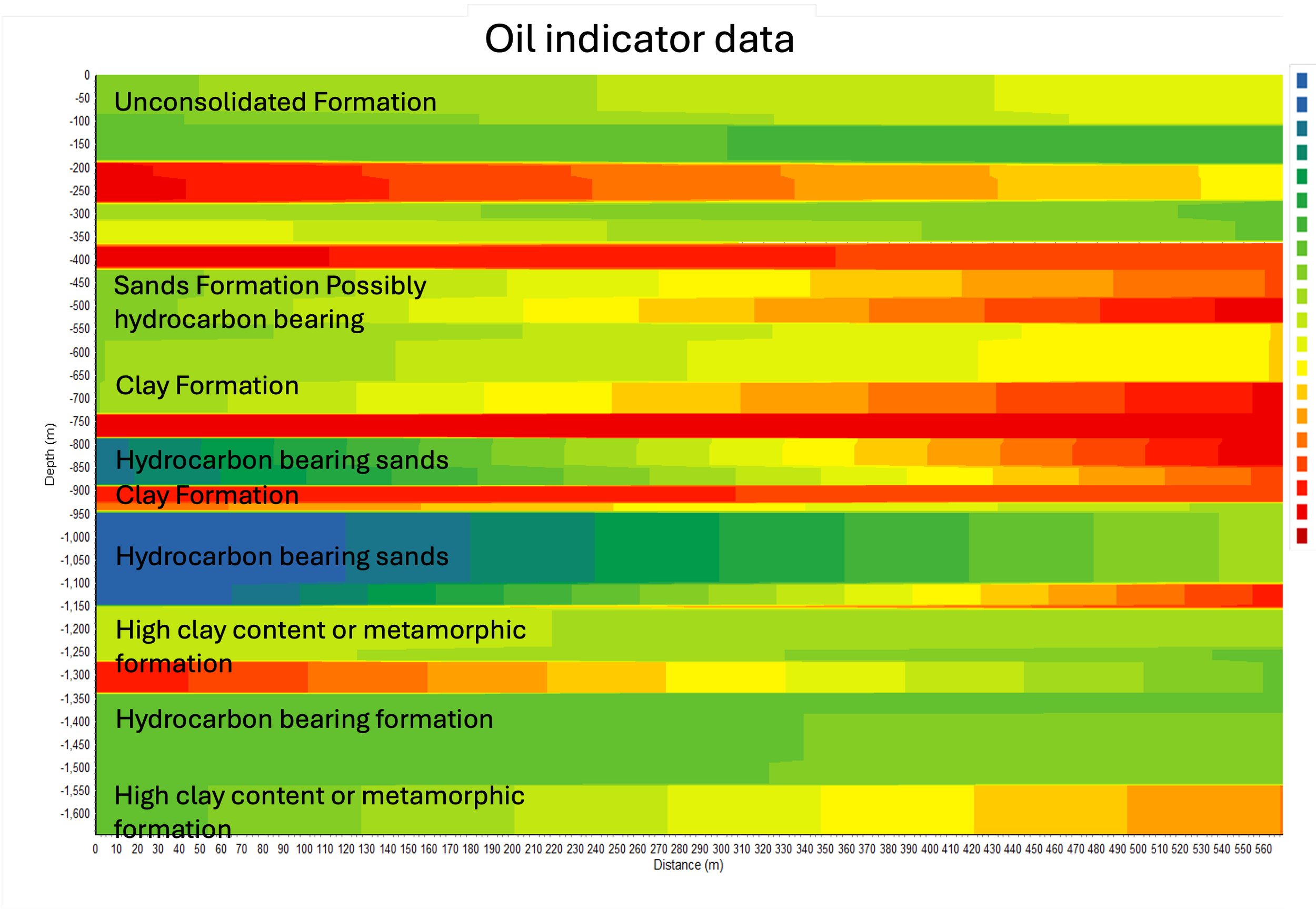
This project was conducted over a heavy oil field, where steam injection was used to facilitate oil extraction. The objective of the study was to delineate the spread of the injected steam within the oil-bearing formations, in order to gauge the effectiveness of steam injection at recovering oil. To accomplish this goal, ES formation temperature data was used to delineate the steam spread. Additionally, ES coupling coefficient data was used to delineate the oil-bearing formations under the site.
Enhanced Geothermal
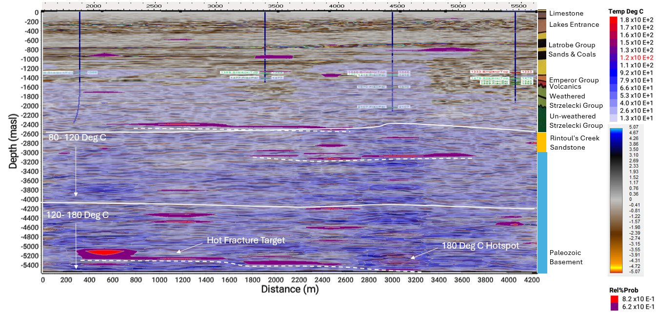
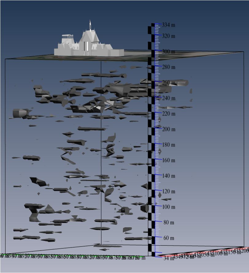
This project was conducted for Lakes Energy in Australia. One of the objectives of the study was to delineate any potential deep earth enhanced geothermal, hot rock geothermal potential. Specifically fractured hot rock. The results, shown below, indicate temperature ranges of 120 to 180 Deg C at depths of between 4200 and 5500mbsl. There is a very large fracture network at a depth of approximately 5200mbgl that may be targeted for enhanced geothermal system develpment.
Magma Chamber Mapping
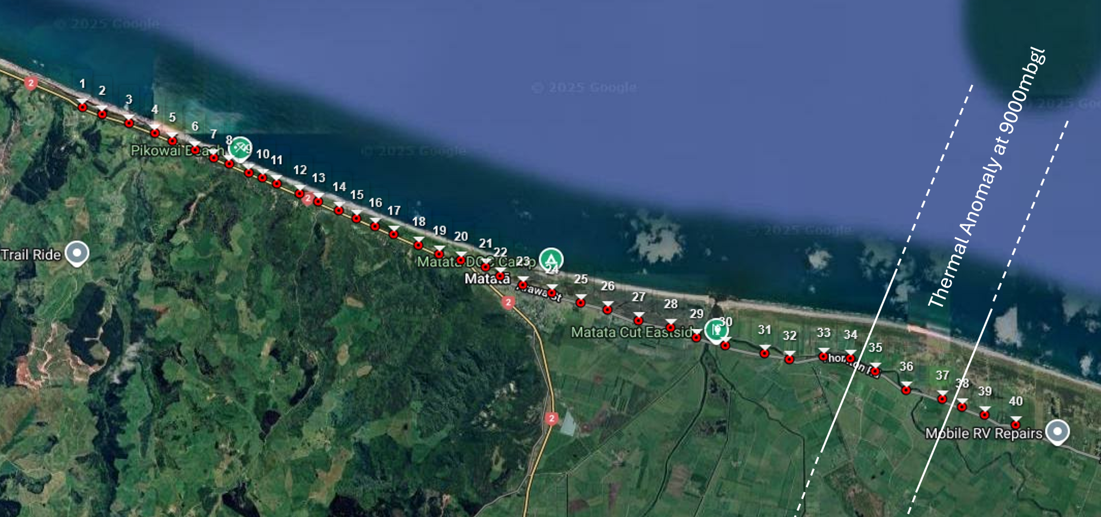
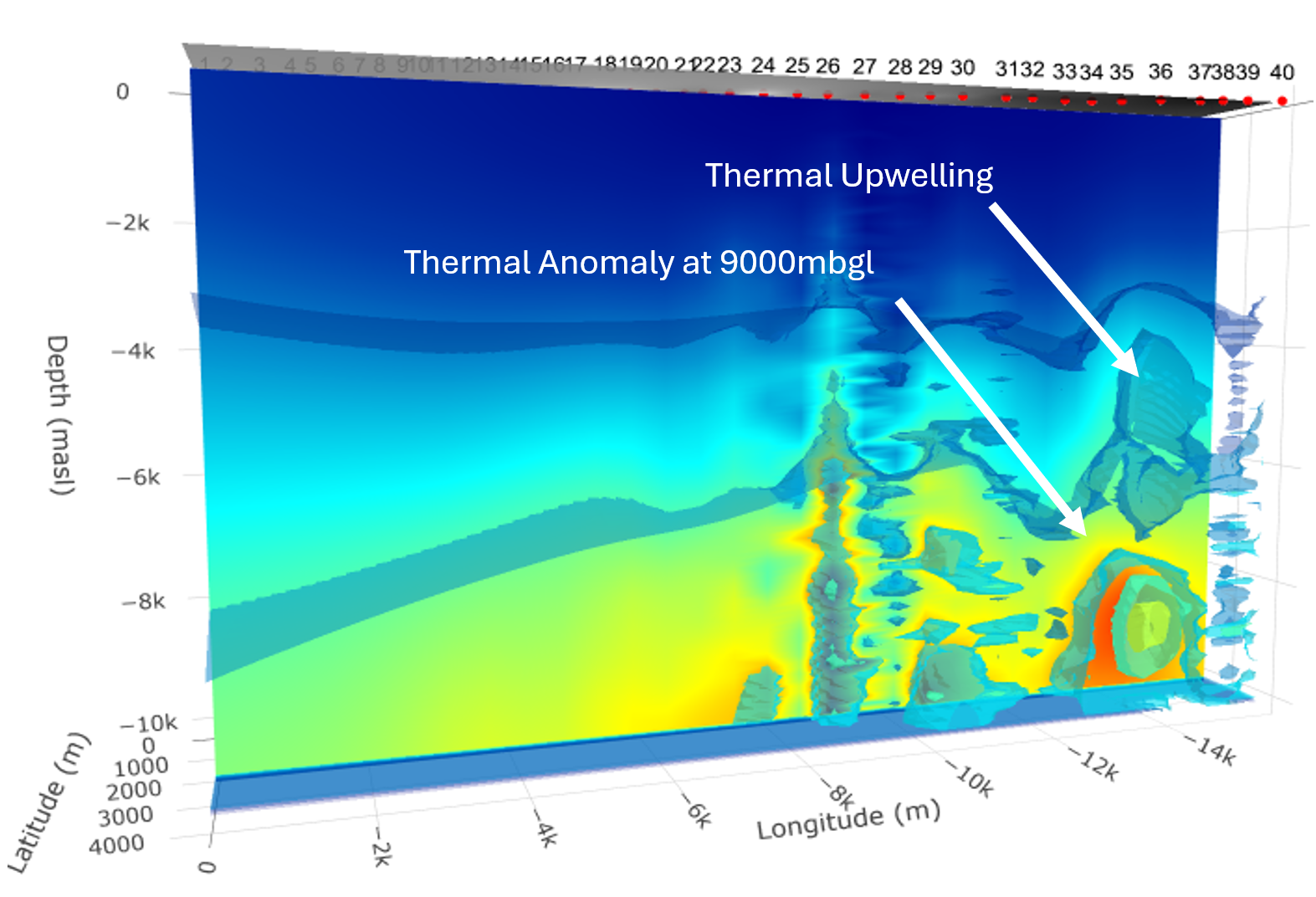
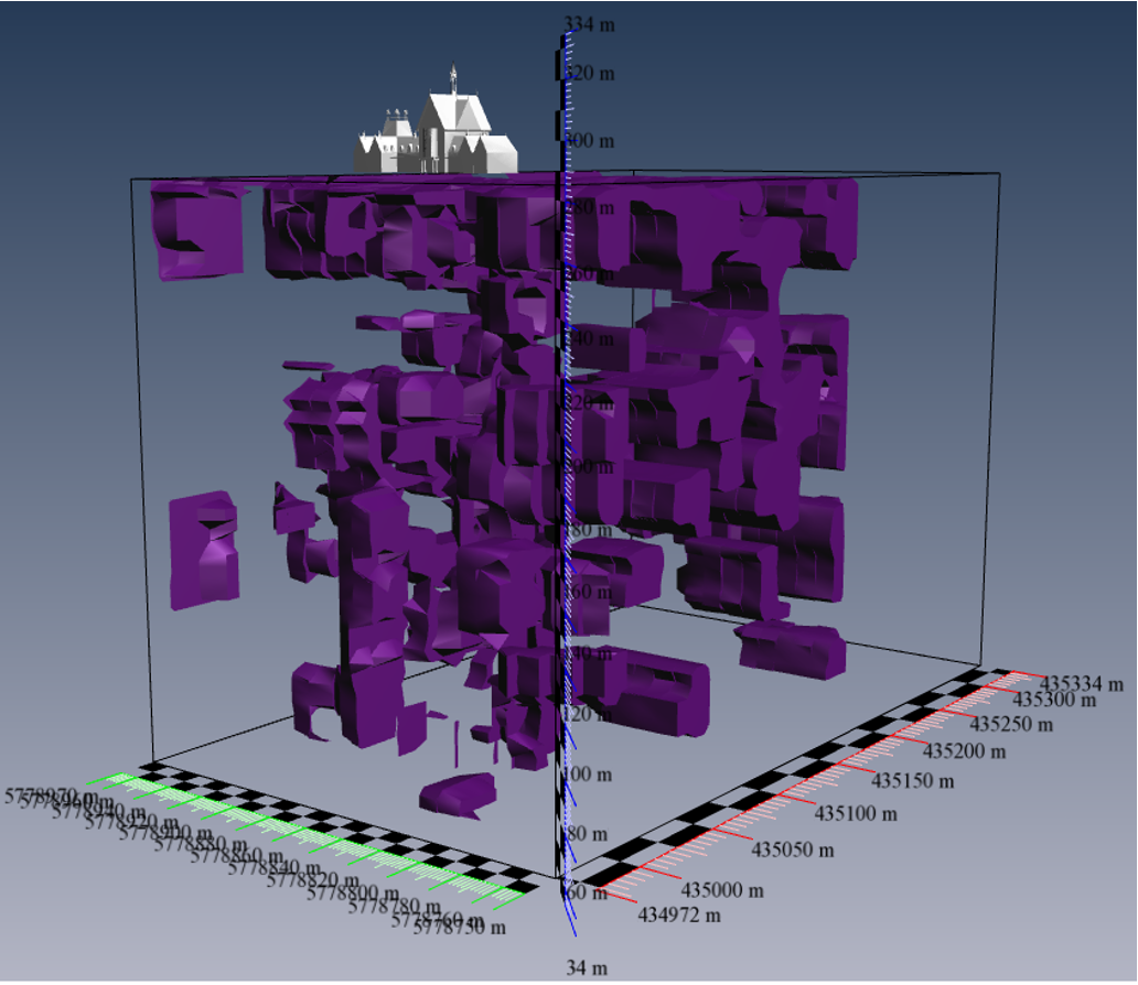
This study was conducted over Matata, BOP, New Zealand to investigate the possibility of existence of a magma chamber at depths to 10000 meters below ground level. The temperature estimates data shown here is calibrated to the standard thermal gradient of the area, of 25 Degrees Celsius per Km. The data shows a thermal anomaly at a depth of 8000 to 10000 meters below ground level that may be indicative of a magma chamber. There also appears to be thermal upwelling above the interpreted anomaly.