Geotechnical Investigations
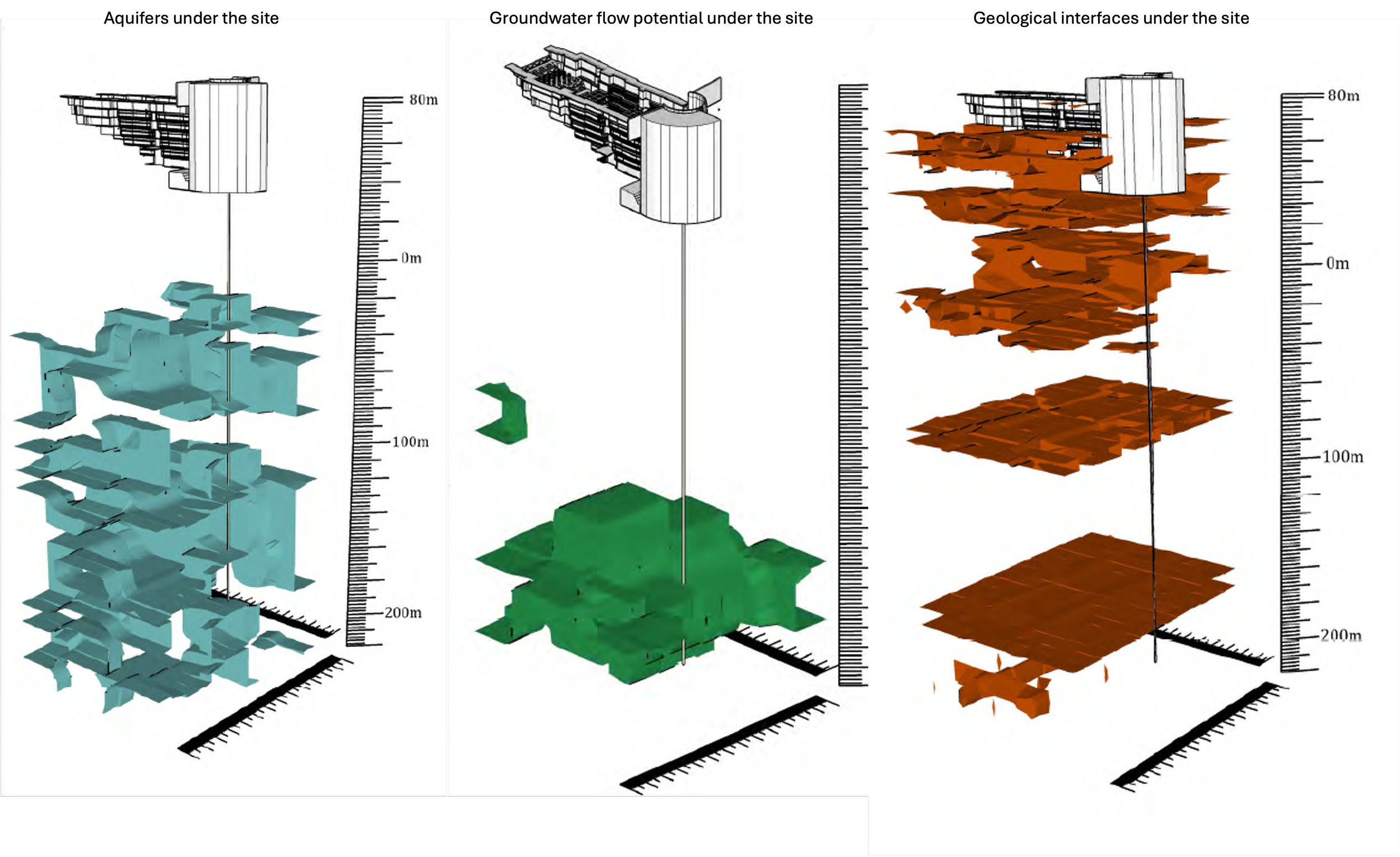
Bridge Site Investigation
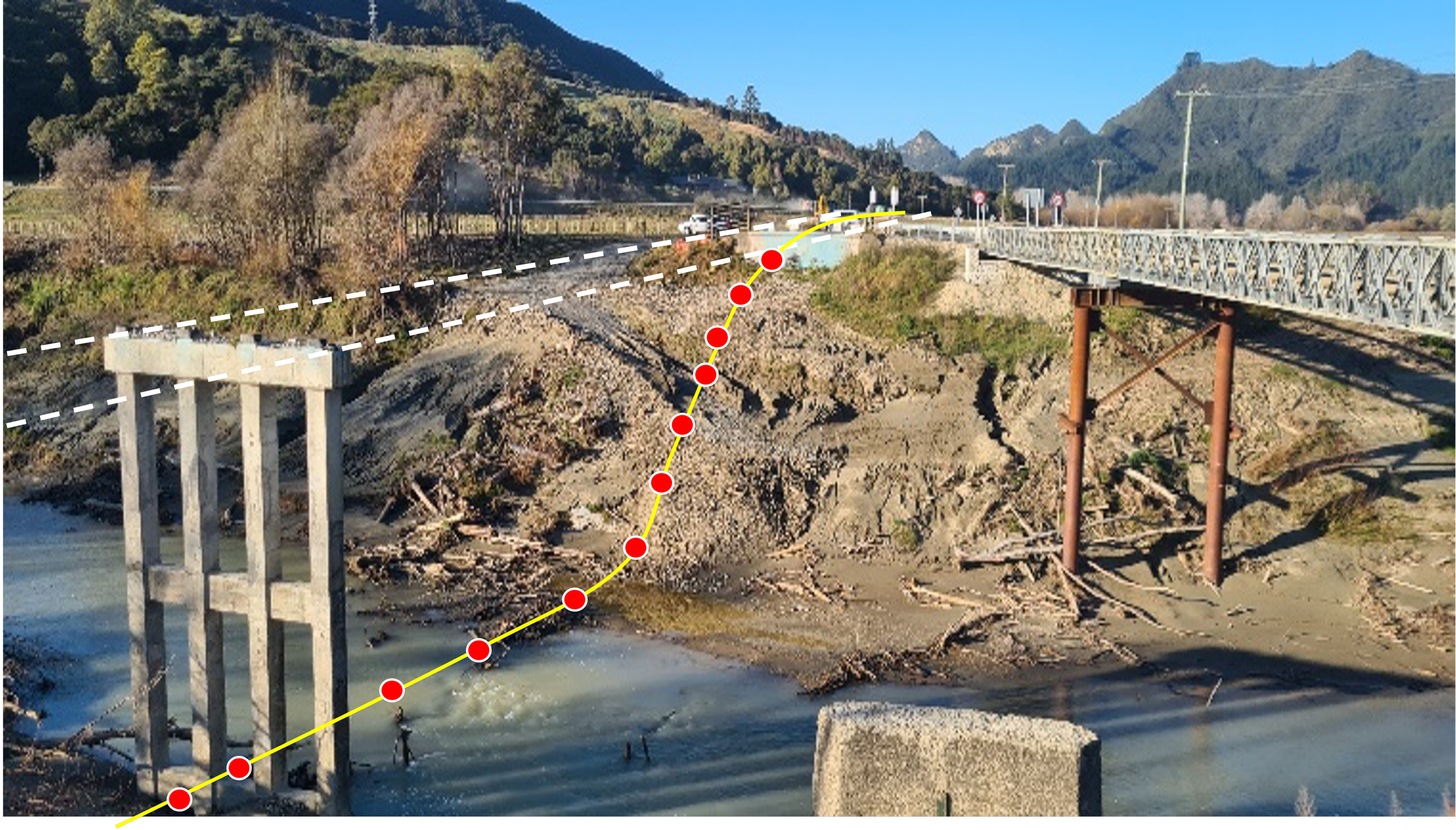
This geotechnical study, located in Poverty Bay, New Zealand, was conducted to evaluate the subsurface geological structures under the construction site of a new bridge being built to replace a bridge that had been washed away. The aim of the study was to collect seismoelectric sounding data under the bridge area in order for civil engineers to evaluate and compare the data against cone penetration test and well logs collected on the site. The reason that the GeoView system was used on this site was due to access issues that restricted other more traditional geotechnical methods, such as CPT from accessing the site. The GeoView sounding data served as a low-cost alternative to filling the geological information between CPT and core drill locations, providing the client with high-resolution information in areas of the site that would not have been possible with other more traditional equipment. Here we can see the construction site with the sounding points overlaying. 76 soundings, both on land and over the water was collected by two crew members over the course of two days using handheld seismic source equipment. The data was processed to a depth of 50 meters below surface level.
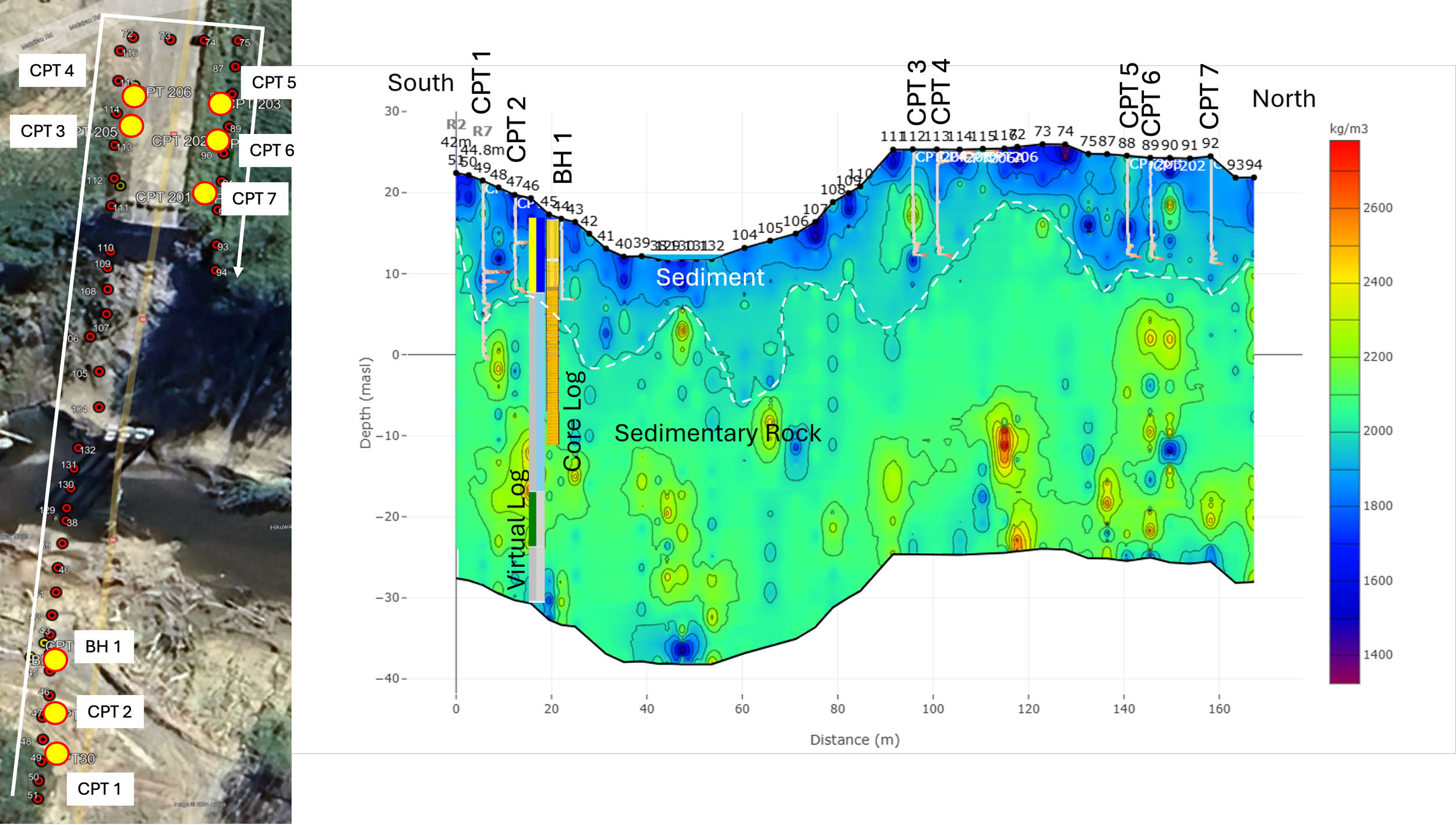
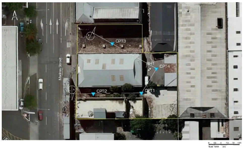
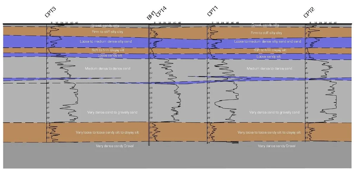
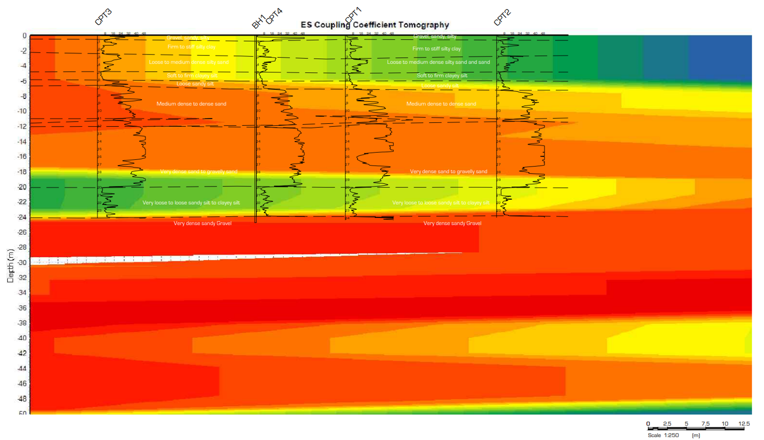
Here we see the survey layout under the bridge section. The sounding locations are marked in red and the CPT and core drill points are marked in yellow. The section plot shown is for the white profile shown on the map and represents the density in kilograms per cubic meter of the formations under the survey line. On the section plot, the CPT data for all the CPT survey points are overlain, as well as one core log. The CPT data indicates the depth to consolidated rock. The density data shows a clear interface between the unconsolidated sands and the consolidated sandstones under the site. When compared against the CPT and core log data, we can see a high degree of correlation between the data sets.
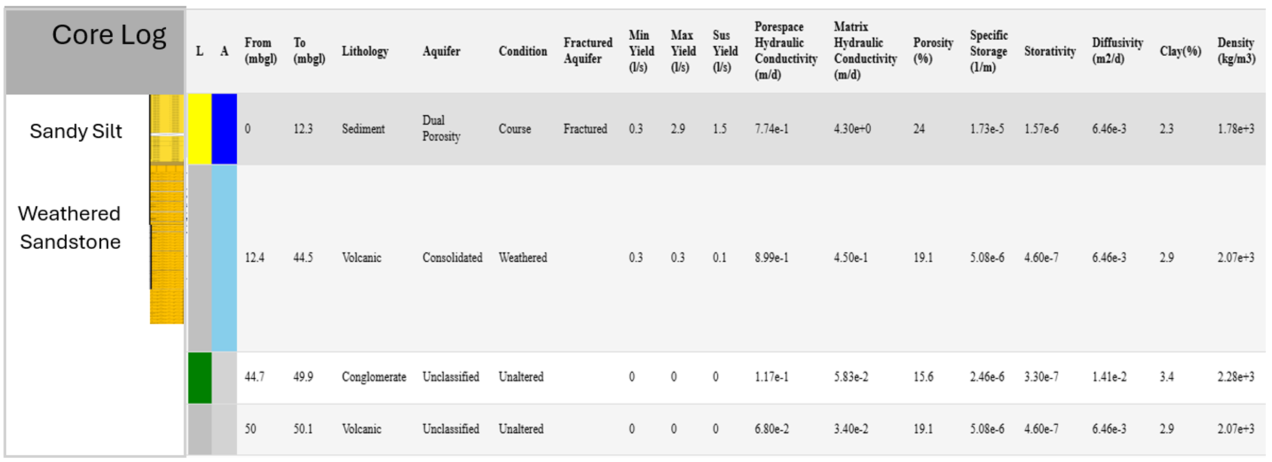
A comparison between the core log and the virtual well log for sounding 46, which is located next to the core log location, indicates a near perfect correlation between the sand to rock interface. Even the rock layer beneath the sand is indicated to be weathered in both logs. The high degree of correlation between the density and CPT data, as well as the core and virtual logs for the site, indicates that the geophysical data for the site accurately represents the known geology and can be used to model the site from a civil engineering standpoint.
Liquefaction Investigation
This geotechnical investigation was conducted in Christchurch, New Zealand to determine the risk of liquefaction damage due to subsurface geological structure in the event of an earthquake. Cone penetration tests conducted on the site revealed the presence of soft sand features under the site. However, due to the restrictive working area and high testing costs, only limited CPT data sets could be collected. The GeoView system was employed as a low-cost alternative to validate the CPT data and fill in the data gaps where CPT could not be conducted.
The low resolution CPT data indicated that the upper eight meters of soft, unconsolidated soils presented the highest risk of liquefaction.
The high resolution GeoView data also indicated that the upper eight meters of soft, unconsolidated soils presented the highest risk of liquefaction, thus validating the CPT data both in depth and in lateral resolution.
Paleo Channel Mapping
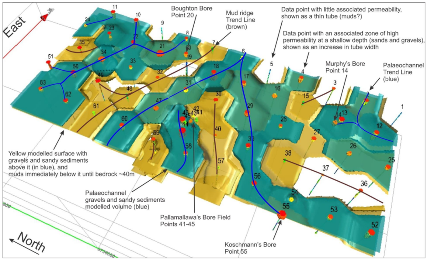
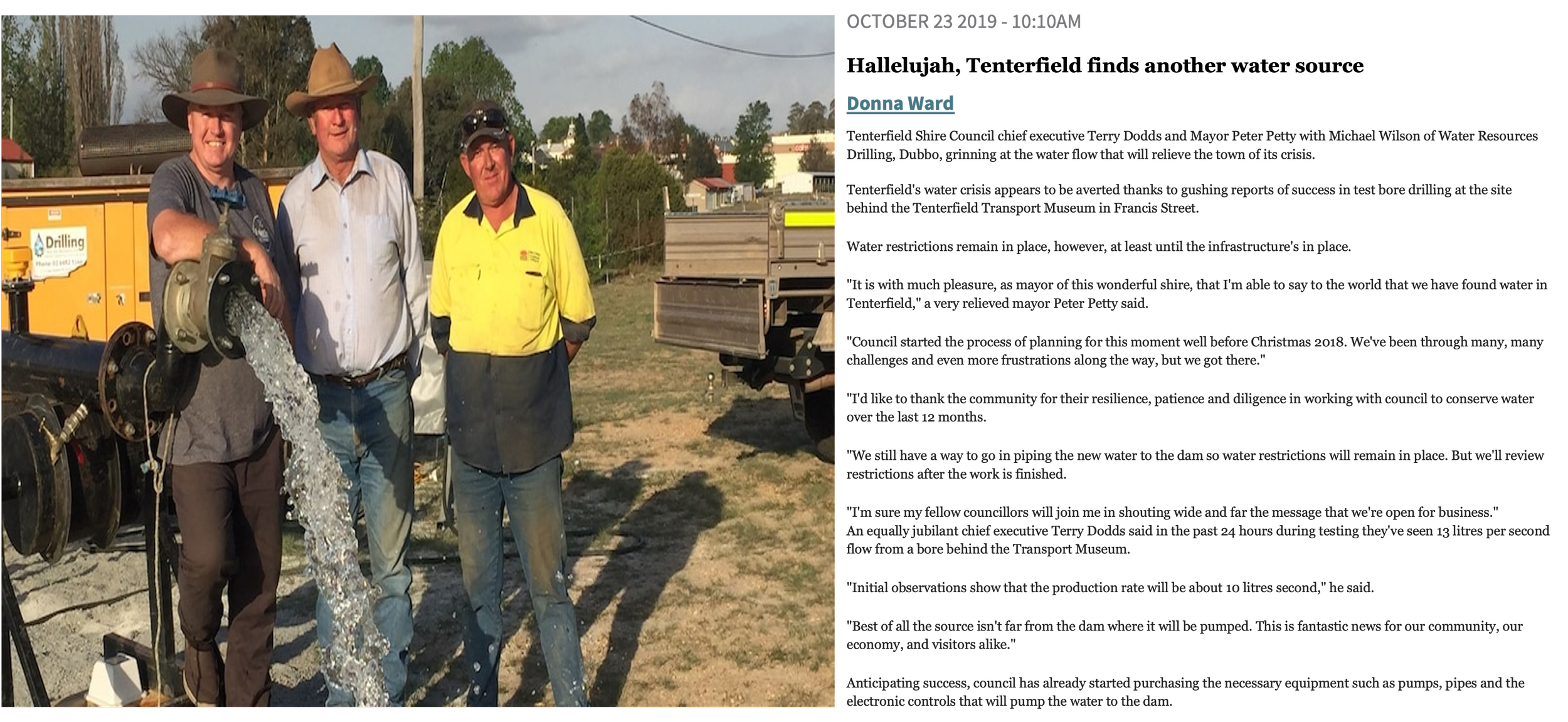
In this study, the town of Tenterfield, New South Wales, Australia had been plagued by a four-year-long drought. Estimates indicated that the town had only 80 days of water left in its storage dams before the town would be left without any water. The town council had drilled eight wells to try supplement the water supply, but all of them had failed. A GeoView affiliate geo-consulting firm based out of Australia was called in to investigate the aquifers in the area surrounding the town in hopes of locating alternative water supplies. The area was surveyed using the GeoView system, and all the aquifers under the town were delineated. Wells drilled into these aquifers produced 30 cubic meters per hour of water for the town, averting a crisis for the residents of Tenterfield. Here we see the results of the investigation of the Tenterfield surrounding area. The data indicated that the groundwater in the area was contained within paleo channel formations. These paleo channel formations were targeted for the placement of the successfully yielding groundwater supply wells for the town.
Salt Cavity Mapping
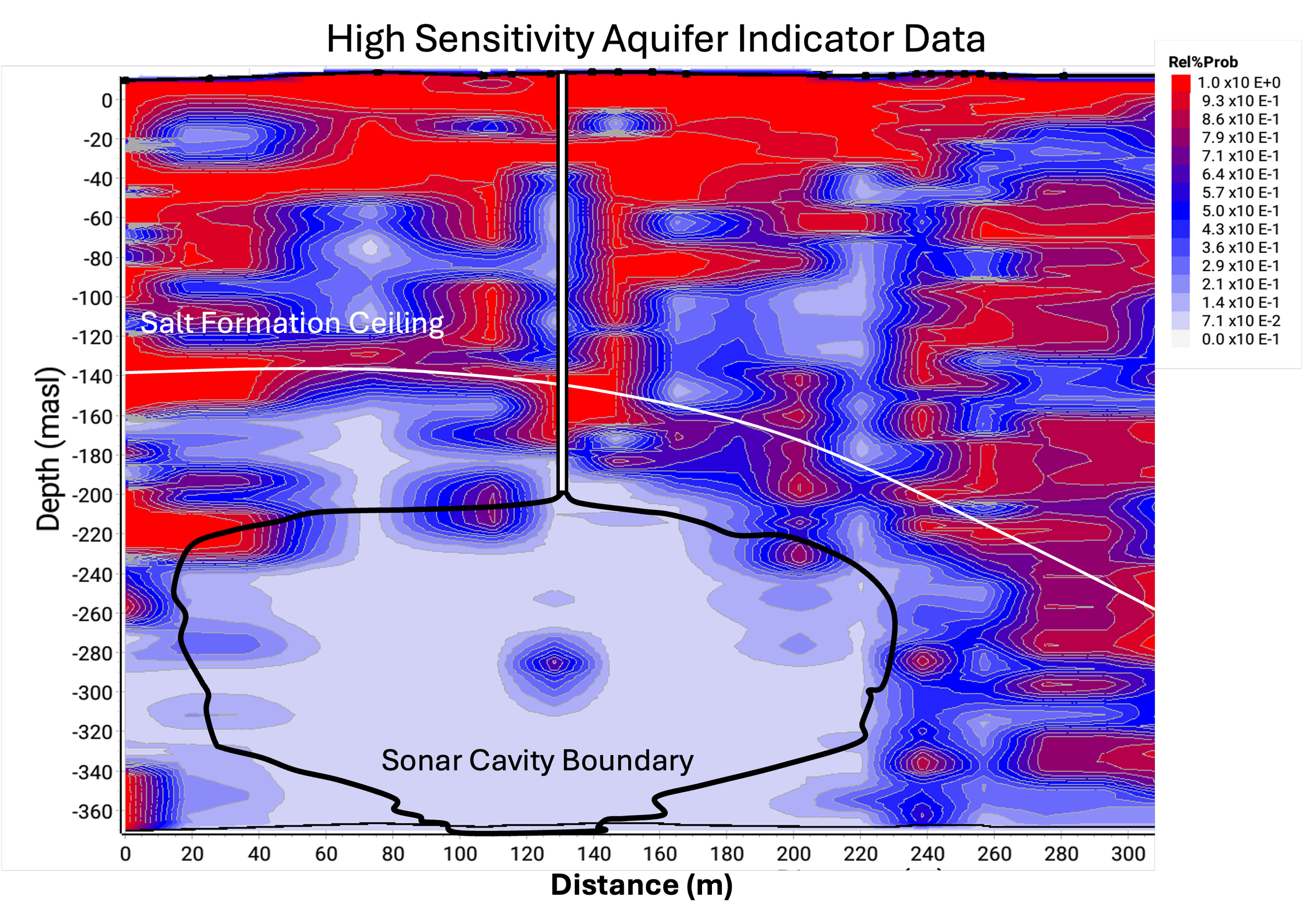
This project was conducted to delineate a known salt cavity. The objective of the study was to determine whether the ES geophysical method is capable of:
1)Delineating the known salt formation interface
2)Delineating a brine filled cavity
3)Delineating the ceiling depth of the known cavity
4)Delineating the lateral boundaries of the known cavity
To accomplish these objectives, the methodology of absence of ES response data in unsaturated, no porous salt formations was used to delineate the salt formation interface. Additionally, the same methodology was employed to delineate the brine filled cavity, which cannot produce an ES response due to the lack of a porous medium within the cavity in which an ES conversion can occur. The high gain aquifer indicator data set was used to test this hypothesis. A comparison between the known well log data for the salt formation interface and the sonically determined cavity boundaries, and the collected ES high gain aquifer indicator data show a strong correlation between the data sets, proving evidence that the ES technique is capable of delineating a brine filled cavity within a salt formation.
Ran-ka-viv World Heritage Site Survey
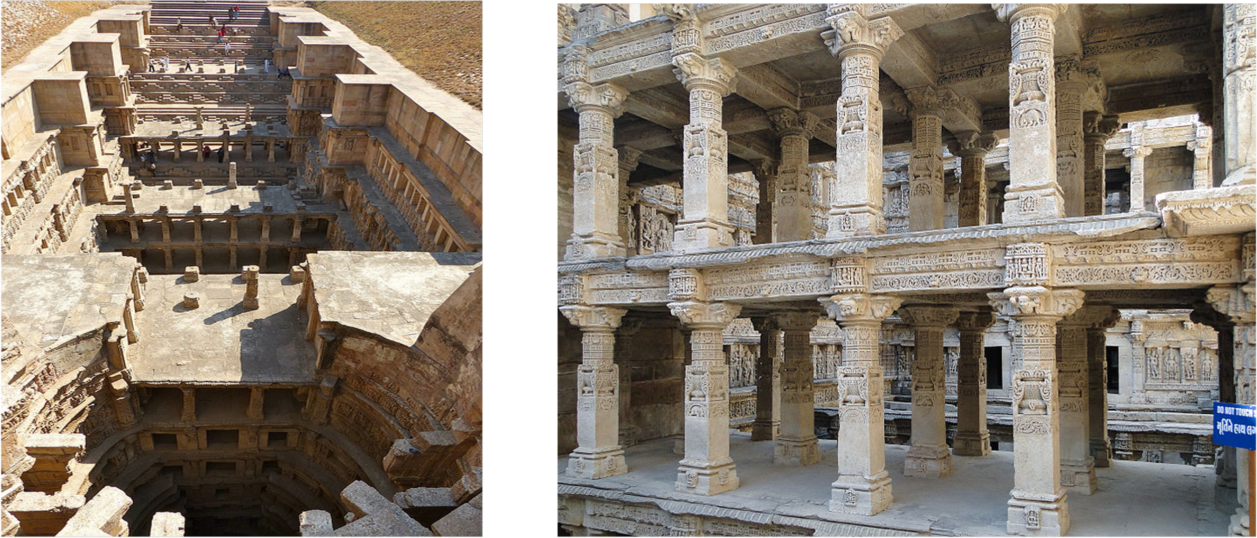
This study of the Rani-ki-Vav UNESCO World Heritage site in India was conducted to evaluate the state of the aquifer systems under the site in order to determine whether the site's natural groundwater level could be synthetically restored.
The data indicated that only deeper aquifers were present under the site, and that most of the shallower aquifers had already been dewatered due to agricultural usage. This allowed the research team to develop groundwater recovery models in order to propose rehabilitation plans to restore the area's natural groundwater level.
Slope Stability Investigation
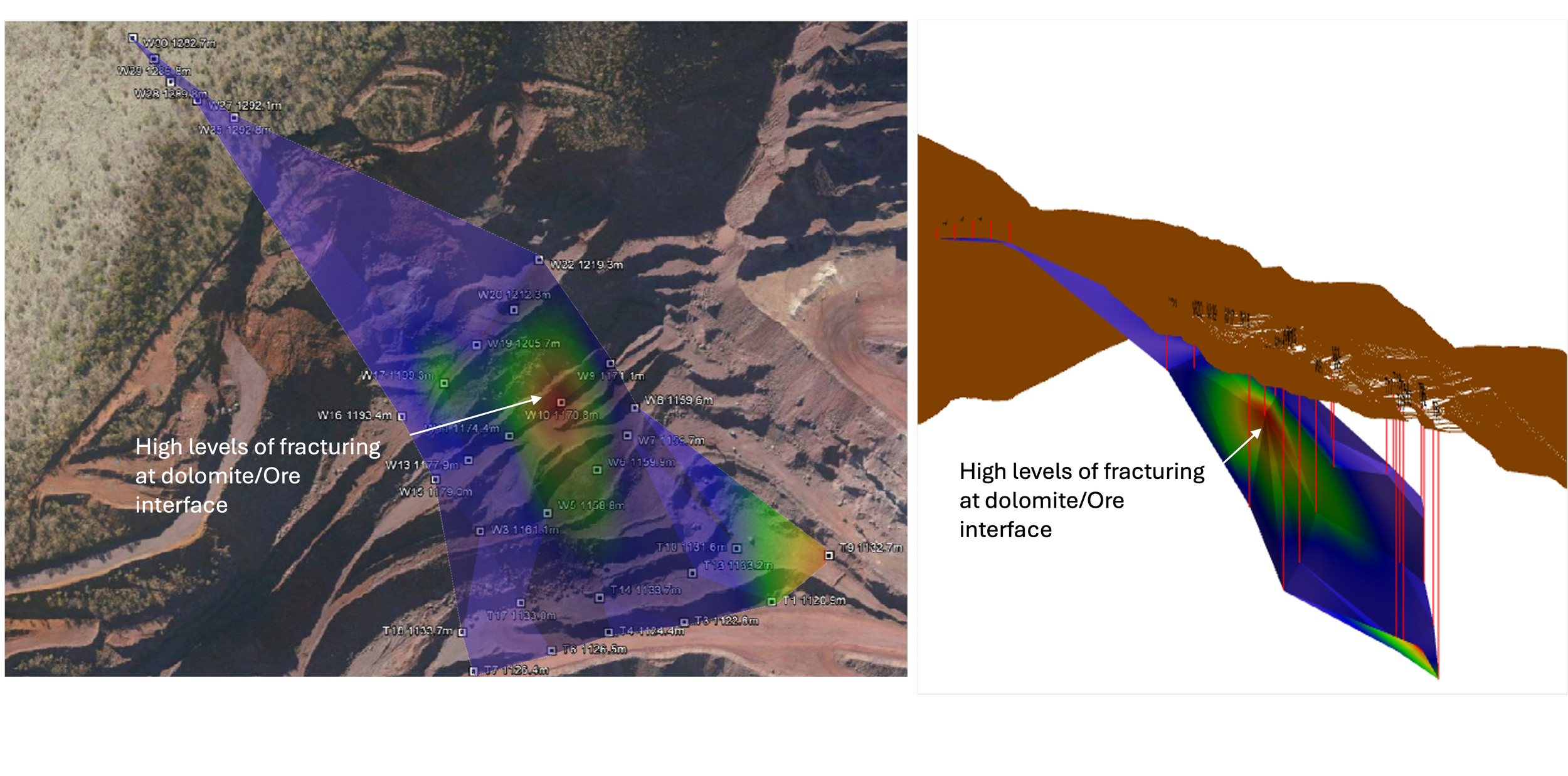
A detailed subsurface analysis that helped stabilise a slipping iron ore mine face in South Africa, improving safety and operational confidence.
At a large iron ore mine in South Africa, the client faced ongoing safety shutdowns due to an unstable mine slope that was slipping and moving unpredictably. Traditional methods weren’t giving clear insight into the geological structure, fault boundaries, or the role of groundwater in the slope movement. Using GeoVue’s electro-seismic technology, the team mapped the subsurface in detail, revealing key geological boundaries and identifying natural water sources contributing to instability. This improved understanding allowed the mine owner to design a targeted dewatering program and make informed engineering decisions that reduced risk and improved operational continuity. The result was a clearer picture of the mine’s geology and hydrology, empowering the client to address the slope stability issues with confidence and precision.